Browsing by type: ‘maps & charts’

Three voyages of James Cook
Graphic of the three voyages of James Cook including the discovery of the east coast of Australia.

All Saints Church Holbeton layout of plots in the graveyard
All Saints Church Holbeton layout of plots in the graveyard prepared by Rosemary Neal.

Deanery of Plympton-Devon
Map of the Deanery of Plympton-Devon from the Devon Family History Society.

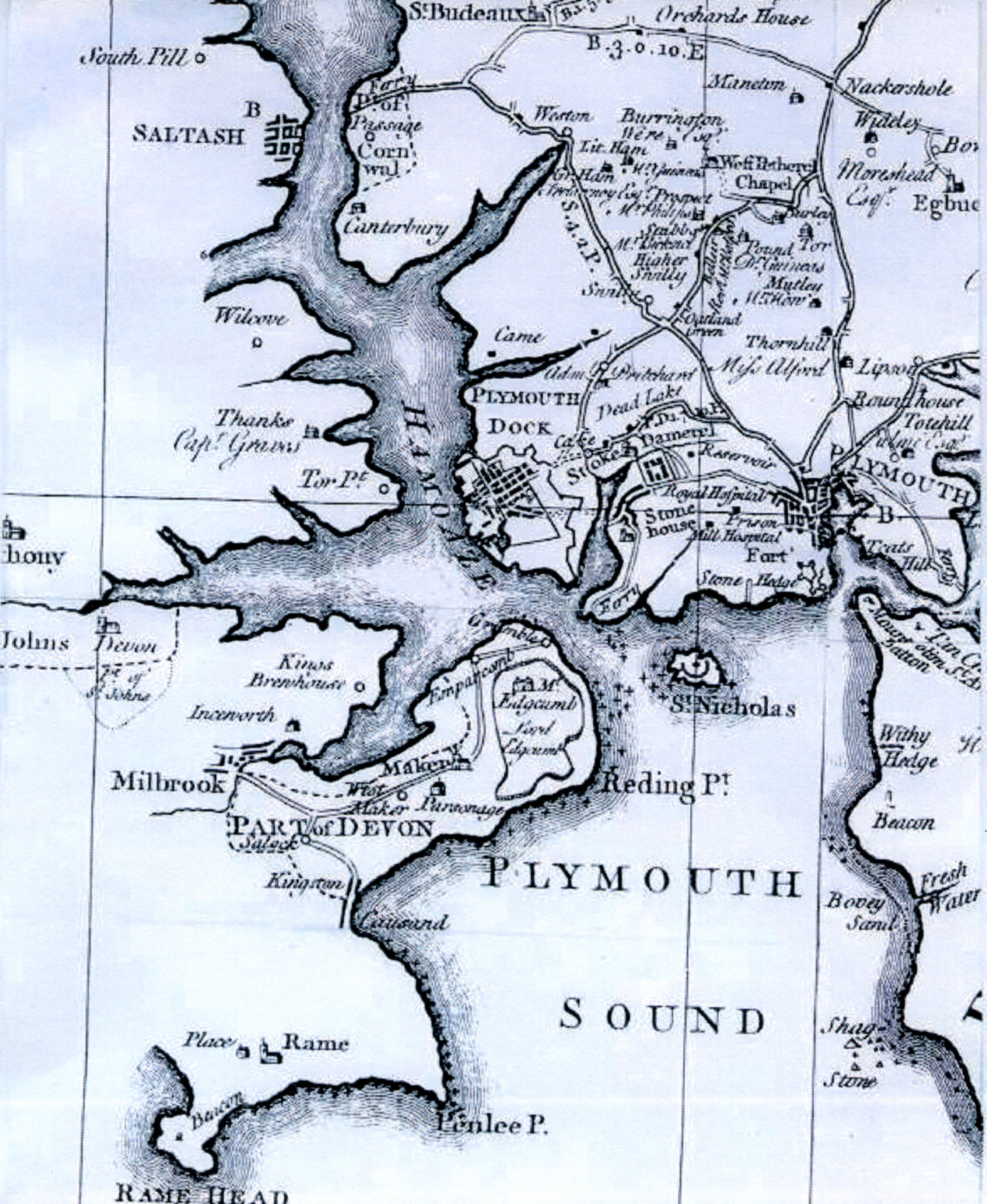
Plymouth
Early Chart of Plymouth showing St. Nicholas Island where John Stone worked before migrating to Australia.

Map of Devonport

Map of Devon

Devonshire
Devonshire historical map.

County Clare Ireland
Map of County Clare Ireland Weiland, C.F. 1853 © Cartography Associates

Cameron Country
Cameron Country Scotland. For more on Scottish Ancestry see Ancestry Tab Stone Family.

First Fleet journey from Portsmouth to Botany Bay
The First Fleet departed Portsmouth on Sunday 13 May. All the ships reached Botany Bay by Sunday 20 January 1788. With the discovery of Sydney Cove as the preferred site for t...

All Saint's Holbeton Stone grave yard plots
Cemetery plan showing designated Stone plots marked in lilac pen kindly prepared by local historian Maureen Kenchington .

St. Nicholas Island (Drakes Island)
Birth place of John Stone St. Nicholas Island now known as Drakes Island at the entrance to the Plymouth Port.